Our burn morel hunting maps have many tools that enable you to plan a successful hunt before you even leave the comfort of your home! While we can’t deny morels are tricksters and don’t always follow predictive behavior, burn morels do use science and can be successfully located using forest type, elevation, burn severity, precipitation, slope, aspect, soil types, temperatures and more.
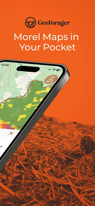
The team at Modern Forager has moved our popular burn morel maps into a mobile friendly application! We have rebranded our foraging maps as GeoForager and will be releasing new layers and functionality on a regular schedule this season!
Now research burns from any medium: mobile, tablet or desktop! Sneak peak of some of the map layers below…
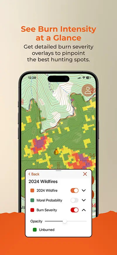
Let us do the work for you! We give you burn perimeters for ALL reported fires in the entire continental US. We then rate fires in 11 western burn morel states from A-D, providing hunting tips and more information for all A-rated fires. Easily find the best fires in the country or just the ones near you.
Offline maps are targeted for release before the season is underway so you can truly take your tech into the field. You will have all the intel you need for a successful hunt!
Predictive Tools
Get access to cutting-edge probability tools that save time during your hunt.
The morel probability layer uses an algorithm to provide terrain based predictions, calling attention to “morel hotspots” – areas where we predict morels will flourish. We use three primary terrain features to create these predictions – tree cover density, slope and aspect. More burned tree cover, gentler slopes (simply for accessible hunting), and North or Northerly aspects gain the highest ratings. This is a great feature especially for beginners!
Burn Severity is calculated using satellite imagery before and after the burn. Sometimes cloud cover interferes, but most A and B fires offer this layer. The most severely burned areas of a fire, “moonscapes”, are typically not great for hunting morels. They burned too hot and left little behind. Morels prefer areas where the trees are severely stressed, dead and dying, dropping healthy beds of brown needles on the shady forest floor.
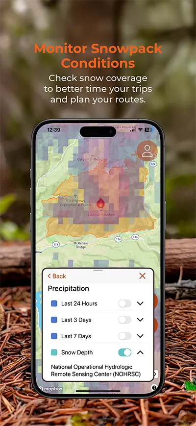
All mushrooms love moisture and morels are no exception. Watching the snowpack on your favorite locations or burns that you’ve targeted can be important. Checking rain patterns is also a very helpful tool.
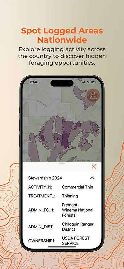
Morels also love a good disturbance. This app will give you access to current snowpack, plus – one, three and seven day precipitation overlays. You’ll also have stewardship maps that show all US forest management activities for the last three years.
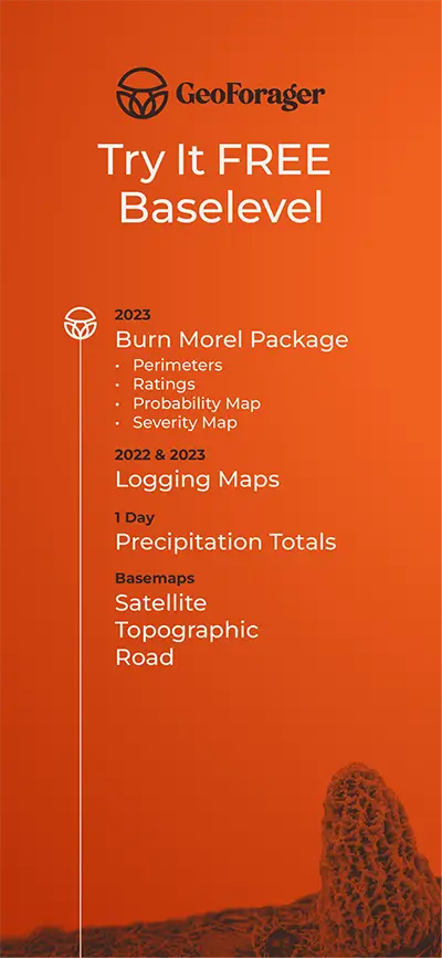
Try it Free or Get the Data NOW
Our free DEMO version will allow you to see how it all works, giving you fire data from 3 seasons past, a few years of logging activity and a glimpse at our precipitation tool. The real power is in the predictive tools however, and the current year of fire data.
We are working hard to make this the best foraging tool around. New features will continue to get baked into the app on a regular schedule!