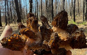
Most of you know that wild mushrooms are entirely precipitation dependent. The problem with many rain and precipitation maps for foragers is that they show a rain forecast, not historical rain data or rainfall totals. As mushroom hunters we care about past rainfall – the last few days or weeks are critical! Furthermore, we want to look at rainfall on a map in order to find out where to go. Often there are nearby areas that have received more rainfall and will likely be much more productive. Precipitation maps are the difference between a full basket and a being skunked.
Precipitation Maps
GeoForager offers the following rainfall maps:
- Last 24 Hours
- Last 3 Days
- Last 7 Days
- Last 7-14 Days
- Last 15-30 Days


If you click on the colored precipitation area in the GeoForager application, the on-click will show you the full details of the time period, for instance, on the 7 day map it shows you actual rainfall for each day of the last 7, not just the total.
Depending on the mushroom, different timeframes may matter. Morels in the mountains, for example, flush much better if it rained regularly – 2, 3 and even 4 weeks ago… while morels in the Midwest tend to be more heavily influenced by the last 3 or 7 days.
Often the last 24 hour report is more useful for planning into the next week, not for choosing where to go today.
GeoForager also offers soil moisture maps which is another helpful precipitation tool.