Map Overlays
Burn Perimeters
We currently have burn perimeters for wildfires in the CONUS (the 48 Contiguous US States), Alaska and British Columbia. We will upload the rest of Canada as soon as the maps are made available. Burns from 2022, 2023 and 2024 are now available. Vital!
Burn Rankings
We rank the top burns in 11 Western states (CA, OR, WA, ID, MT, WY, UT, NV, NM, CO, AZ), rating them on A – D scale. We have 90 A rated burns in 2025 from the 2024 wildfire season. Canada and Alaska burns stay un-ranked, there are far too many. All A and B fires also include a commentary with recommendations. These rankings help you quickly focus in on the best fires. Irreplaceable!
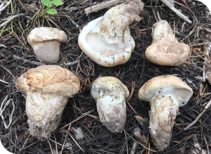
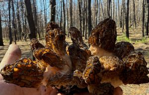
Morel Probability
GeoForager creates acre-by-acre map overlays to predict where burn morels will flourish. Based on tree cover, aspect and slope of the terrain, these predictive maps help you find the best spots. Treasured!
Burn Severity
GeoForager calculates the severity of the burn by evaluating the infrared spectrum of satellite imagery and comparing the before and after results. These are called dNBR maps. This helps foragers find the right degree of burn severity for morels. Typically we avoid hunting in moonscapes – areas that burned so hot nothing is left. Valued!
Logging Maps
Morels love a good disturbance. We scour the forest service websites to find online maps of logged areas and spots where “stewardship” has occurred. These help foragers find disturbance morels. Awesome!
Forest Type
Geoforager provides a forest type overlay with 30 types of forest. This helps you find desirable forests like fir/spruce, ponderosa, Douglas fir. Cherished!
Precipitation Maps
GeoForager provides rain maps for the last 1 day, 3 day and 7 day cycle. Foragers don’t need to see today or tomorrows rain, they need to see historic rain to decide where to go. Invaluable!
Snowpack Maps
We provide up-to-date snowpack maps showing how deep the snow is right now. These are helpful especially earlier in the season for foragers to keep tabs on where the snow ends and the morels begin. Cool!
Elevation Ranges
Select a custom elevation range (low to high) and the map will show you exactly where that elevation target is inside each fire. Finding the right elevation range during the right season is critical! Foragers use this to quickly find elevations instead of deciphering topo lines. Priceless!
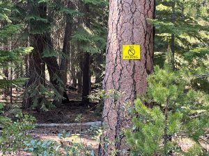
Public Access
GeoForager maps provide a PAD-US (Protected Areas Database of the United States) overlay. Foragers use this to find public land and research its public availability. It makes avoiding private lands while foraging a breeze. Important!
Motor Vehicle Routes
GeoForager provides overlays of MVUM (Motor Vehicle Usage Maps). Theoretically, these USFS provided maps are the most up-to-date and authoritative source of every forest road (and its access rules). Foragers use these to find road access. Helpful!
Basemaps
- Forest Service: The goto for boundaries, roads, access, landmarks and designations. Favorite!
- Topo Map: Topography maps are a goto for studying slopes, aspects and drainages. Required!
- Satellite Map: Invaluable for researching terrain and habitat. Both Google and Mapbox versions are available. Necessary!
- Road: Standard road maps, the least useful generally. Handy!
Click “Get Burn Maps” in the top right corner to download your free trial or get the current year’s burn maps today! Questions? Feel free to reach out to us at info@geoforager.com.